GOES, or NOAA’s Geostationery satellite system, works around the clock providing the kind of continuous monitoring necessary for intensive data analysis. It provides constant watch for atmospheric “triggers” for tornadoes, ash oods, hail storms, and hurricanes, and space weather.
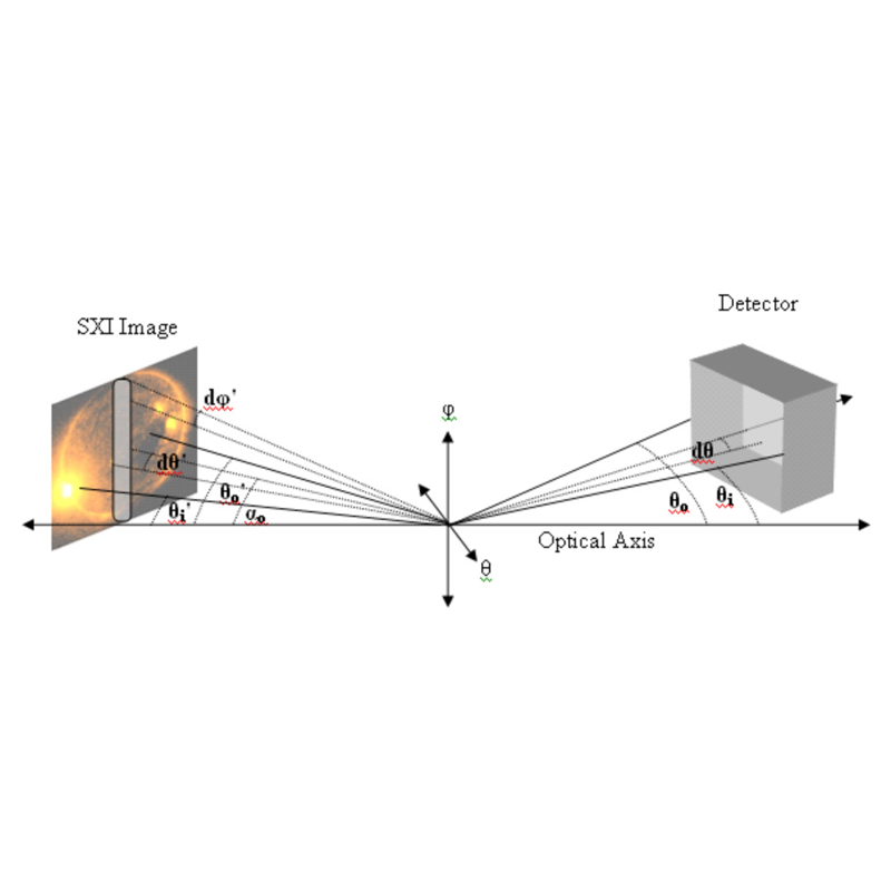
Soon after the launch of GOES-N, SSRC led a team of experts to investigate and validate portions of the Post Launch Test (PLT) period data. SSRC used the as-built sensor drawings to create an end-to-end mathematical model of the instrument. Using this model, the team studied the optimal and non-optimal alignments of the sensor. Results were evaluated and algorithms developed to provide data processing corrections and validate the performance of the sensor.